 GéoGuyane
Format
UTF-8
Domaines
Harvested
Provided by
Type of resources
Available actions
Topics
Provided by
Years
Formats
Representation types
Scale
From
1
-
1
/
1
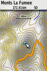
-
Fond de carte au format propriétaire de Garmin (IMG) sur le département Guyane intégrant la topographie (tirée du SRTM30m corrigée par le PAG) et l'hydrographie de la BD Carthage. LE FICHIER IMG EST A ENREGISTRER DIRECTEMENT DANS LE REPERTOIRE "GARMIN" DE VOTRE GPS. Nous vous conseillons de le compléter avec un fond de carte OSM pour les secteurs urbains.