Fond de carte topographique pour GPS Garmin
Fond de carte au format propriétaire de Garmin (IMG) sur le département Guyane intégrant la topographie (tirée du SRTM30m corrigée par le PAG) et l'hydrographie de la BD Carthage.
LE FICHIER IMG EST A ENREGISTRER DIRECTEMENT DANS LE REPERTOIRE "GARMIN" DE VOTRE GPS.
Nous vous conseillons de le compléter avec un fond de carte OSM pour les secteurs urbains.
Simple
- Date (Creation)
- 2019-03-11
- Citation identifier
- https://catalogue.geoguyane.fr/geonetwork/srv/db81a590-9204-4c44-8fa5-0784d46d452d
- Point of contact
-
Organisation name Individual name Electronic mail address Role Parc amazonien de Guyane
Joubert Pierre
Point of contact
-
Régions de France
-
-
GUYANE
-
-
GEMET - INSPIRE themes, version 1.0
-
-
Systèmes de maillage géographique
-
- Keywords
-
- Use limitation
-
Données ouvertes
- Access constraints
- Copyright
- Use constraints
- Copyright
- Spatial representation type
- Vector
- Denominator
- 5000
- Language
-
fre
- Character set
- UTF8
- Topic category
-
- Imagery base maps earth cover
- Description
-
Guyane
- Begin date
- 2019-04-10
- Description
-
GUYANE
- Description
-
GUYANE
))
- Reference system identifier
- EPSG / RGFG95 / UTM zone 22N (EPSG:2972) / 8.6
- Distribution format
-
Name Version UTF-8
UTF-8
- OnLine resource
-
Protocol Linkage Name WWW:DOWNLOAD-1.0-http--download
https://catalogue.geoguyane.fr/geonetwork/srv/api/records/db81a590-9204-4c44-8fa5-0784d46d452d/attachments/Topo_hydro_2019.img Topo_hydro_2019.img
- Hierarchy level
- Dataset
Conformance result
- Date (Publication)
- 2022-03-27
- Pass
- Yes
- Statement
-
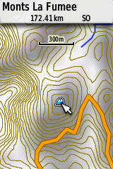
Les courbes topographiques sont celles produites par le PAG et mises à disposition sur GéoGuyane. Elles sont tirées d'un traitement du SRTM à 30m avec correction des puits topographiques (Réalisation : PAG).
La BD Carthage (2015) est intégrée aussi au fond de carte.
Les couches individuelles ont été préparées grace à mapedit++ et cgsmapper. Elles ont été assemblées avec Mapwell.
Metadata
- File identifier
- db81a590-9204-4c44-8fa5-0784d46d452d XML
- Metadata language
-
fre
- Character set
- UTF8
- Hierarchy level
- Dataset
- Date stamp
- 2023-06-23T07:47:37
- Metadata standard name
-
ISO 19115:2003/19139
- Metadata standard version
-
1.0
- Metadata author
-
Organisation name Individual name Electronic mail address Role PAG - Parc amazonien de Guyane
Joubert Pierre
Point of contact
Overviews
Spatial extent
Provided by
