 GéoGuyane
Product
Harvested
Provided by
Type of resources
Available actions
Topics
Keywords
Provided by
Representation types
-
These maps are prepared on the basis of vector-based mapping data (IHO S-57 format) including the detailed description of each object (beacons, wrecks, submarine cables, regulated zones, survey systems, etc.). These maps are the digital equivalent of printed nautical charts.
-

The georeferenced digital image solution for the nautical chart is a digital conversion of the corresponding printed nautical chart produced by Shom or its legends, with georeferencing indications and including miscellaneous text.
-
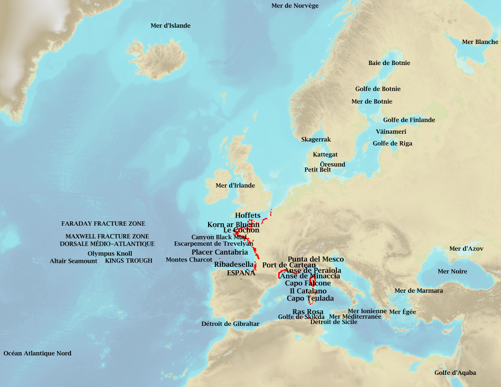
Marine toponymy data layer obtained from French ENC and created using the S23 (4th edition, June 2002). Note: The usual Sea of Japan designation does not imply taking a stand in the dispute between Korea, which names this sea "East Sea", and Japan, which names it "Sea of Japan".
-
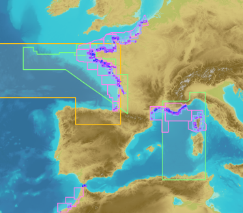
French Ministry of Culture / DRASSM – Shom The product "Limit of preventive archeology licence fee" contains the limits for the preventive archeology licence fee (1 nautical mile) as defined in the French Heritage Code. This limit is managed by the Department of Underwater Archeological Research (DRASSM) of the Ministry of Culture. This limit, defined by the Heritage Code at 1 nautical mile from the low-water line, permits to delineate the areas where the licence fee for preventive archeology at sea is applied. In Mainland France in the Gironde estuary, the limit for the preventive archeology licence fee is stopped by the crosswise limit of the sea as defined by the decree of 26 August 1857. In French Guiana, the limit for the preventive archeology licence fee is stopped in Maroni and Oyapock rivers by the crosswise limits of the sea respectively defined the order of 30 January 1991 and the order No 863 of 26 May 1986, until meeting the land boundary which delineates the rivers with the neighbouring States. The product "Limit of preventive archeology licence fee" is to use in addition to the digital product “Maritime Limits and Boundaries” of Shom (French: “Délimitations maritimes”) which represents the limits of the French maritime spaces of sovereignty or jurisdiction through the World. The product “Maritime Limits and Boundaries” (French: “Délimitations maritimes”) can be viewed on data.shom.fr (Maritime boundaries Category) and downloaded on the French national portal of maritime limits (https://maritimelimits.gouv.fr).
-
French Ministry of Agriculture and Food / DRASSM - Shom<br /> The product "Limits related to fishery uses" contains the limits related to fishery uses as defined in the French or European legislations. Those limits are managed by the Directorate for Sea Fisheries and Aquaculture (DPMA) of the Ministry of Agriculture and Food. <br /> Those limits are divided into three categories : <br /> - the inner limit of the coastal waters (6 nautical miles) ; <br /> - the 3-nautical-mile limit ; <br /> - the limit of fisheries for overseas territories (100 nautical miles).<br /><br /> The product "Limits related to fishery uses" is to use in addition to the digital product “Maritime Limits and Boundaries” of Shom (French: “Délimitations maritimes”) which represents the limits of the French maritime spaces of sovereignty or jurisdiction through the World.<br /> The product “Maritime Limits and Boundaries” (French: “Délimitations maritimes”) can be viewed and downloaded on the French national portal of maritime limits (https://maritimelimits.gouv.fr).
-
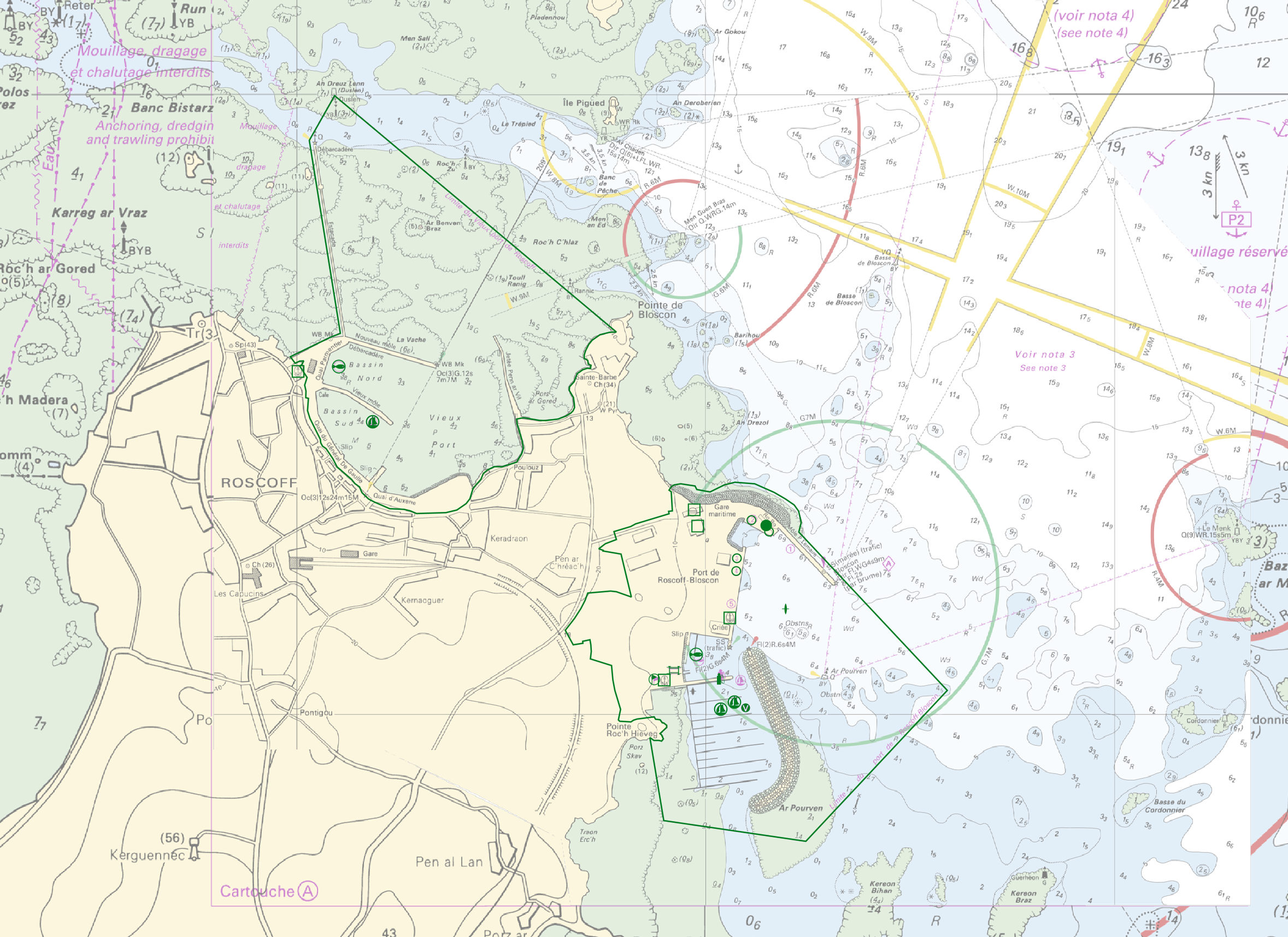
"Harbour Information" product contains 13 object classes, the acronyms used are those of IHO standard S-57 - International Hydrographic Organization – (https://iho.int/): - Berth (BERTHS): place in which a ship is moored at wharf - Isolated building localizing a harbour office (BUISGL) - Checkpoint (CHKPNT) - Crane (CRANES) - Floating dock (FLODOC): floating structure of one or more sections which can be partly submerged by controlled flooding to receive a vessel, then raised by pumping out the water so that the vessel's bottom can be exposed for maintenance. - Gridiron (GRIDRN): structure in the intertidal zone serving as a support for vessels at low tide to permit work on the exposed portion of the vessel's hull. - Harbour area (HRBARE) : administrative area of a port, including all docking and handling facilities, as well as short-term storage facilities. - Harbour facility (HRBFAC) - Hulk (HULKES) : hull of a wrecked or condemned ship, from which the fittings and superstructure have usually been removed, which is moored in a permanent position or grounded. - Oil barrier (OILBAR) - Pilot boarding place (PILBOP) - Rescue station (RSCSTA) - Small craft facility (SMCFAC) Detailed definitions of each of these object classes can be found in the S-57 standard (https://iho.int/en/standards-and-specifications). An online catalog is available at http://www.s-57.com/. Some of the symbols used for display on data.shom.fr portal have been adapted from icons from the OpenSeaMap open library (https://github.com/OpenNauticalChart/).
-
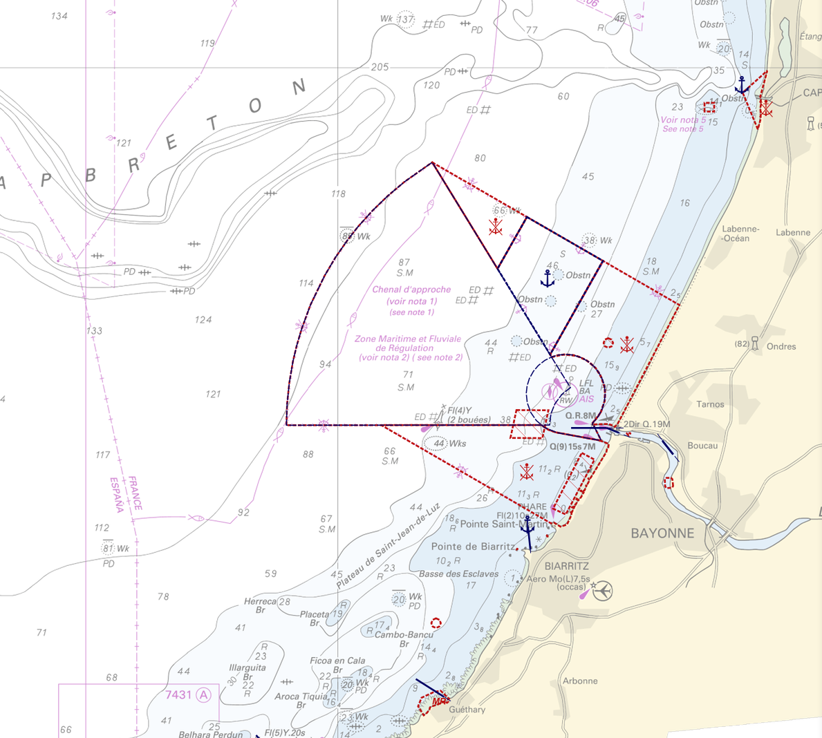
"Regulation - Navigation" product contains 18 object classes, the acronyms used are those of IHO standard S-57 - International Hydrographic Organization – (https://iho.int/): - Anchorage area (ACHARE): an area in which vessels anchor or may anchor. - Anchor berth (ACHBRT): a designated area of water where a single vessel, sea plane, etc. may anchor. - Administration Area (Named) (ADMARE) - Cable area (CBLARE) - Coastguard station (CGUSTA) - Cargo transhipment area (CTSARE) - Distance mark (DISMAR): mark indicating the distance on canals or rivers. - Dumping ground (DMPGRD): sea area where dredged material or other potentially more harmful material e.g. explosives, chemical waste, is deliberately deposited. - Fairway (FAIRWY): part of a river, harbour etc. where the main navigable channel for vessels of larger size lies. It is also the usual course followed by vessels entering or leaving harbours and sometimes called "ship channel". - Ice area (over land or water) (ICEARE) - Local magnetic anomaly (LOCMAG): anomaly of the magnetic field of the earth, extending over a relatively small area, due to local magnetic influences. - Marine farm/culture (MARCUL) - Navigation line (NAVLNE): a line generally passing through two clearly defined charted landmarks, and along part of which a vessel can approach safely. - Pipeline area (PIPARE) - Recommended track (RECTRC): track of undefined width, recommended to all or only certain vessels. - Restricted area (RESARE): specified area designated by an appropriate authority within which navigation is restricted in accordance with certain specified conditions. - Sea-plane landing area (SPLARE) Detailed definitions of each of these object classes can be found in the S-57 standard (https://iho.int/en/standards-and-specifications). An online catalog is available at http://www.s-57.com/. Some of the symbols used for display on data.shom.fr portal have been adapted from icons from the OpenSeaMap open library (https://github.com/OpenNauticalChart/). For reasons of readability, not all the characteristics of the objects are systematically displayed. All available information can be consulted by querying this layer.