Keyword
Imagery base maps earth cover
Harvested
Provided by
Type of resources
Available actions
Topics
Keywords
Contact for the resource
Provided by
Years
Formats
Representation types
Update frequencies
status
Resolution
From
1
-
2
/
2
-
The georeferenced digital image solution for the nautical chart is a digital conversion of the corresponding printed nautical chart produced by Shom or its legends, with georeferencing indications and including miscellaneous text.
-

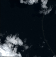
Subset of the Pléiades image that covers the experimental station Paracou in French Guiana.
 GéoGuyane