Outil du Foncier Agricole de Guyane (service WMS)
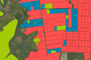
L'Outil du Foncier Agricole de Guyane est un navigateur cartographique dont l'objectif est d'identifier les parcelles agricoles disponibles sur le domaine privé de l’État en Guyane afin d'aider les agriculteurs dans leur démarche de recherche de foncier.
Simple
Identification info
- Date (Publication)
- 2016-02-03T16:00:00
- Date (Creation)
- 2016-02-03T00:00:00
- Citation identifier
- https://catalogue.geoguyane.fr/geonetwork/srv/0226cfd7-09c6-4db1-be14-ab19de30322c
- Point of contact
-
Organisation name Individual name Electronic mail address Role DAAF Guyane
Requillart thomas
Point of contact
-
Régions de France
-
-
GUYANE
-
-
INSPIRE Service taxonomy
-
-
infoMapAccessService
-
-
Domaines
-
-
DAAF
-
FONCIER_AGRICOLE
-
ASP
-
GRAND_PUBLIC
-
- Classification
- Unclassified
- Use limitation
-
Aucune condition ne s’applique
- Access constraints
- Other restrictions
- Other constraints
-
Pas de restriction d’accès public selon INSPIRE
- Service Type
- view
- Description
-
Service de visualisation de GéoGuyane
))
- Coupled Resource
-
Operation Name Scoped name Identifier GetCapabilities
SCAN 500? 1995 640b2706-1a5a-4ac0-8b69-4ff0855c3e3b
GetCapabilities
Autre propri?t? fonci?re (2014) 08a59540-6ab1-4f8a-a84f-8f1882b1fa16
GetCapabilities
Zone inondable (2005) cd457871-6f7a-43d6-9db9-57f8eb3caf3f
GetCapabilities
Autorisation d'exploitation mini?re AEX (2016) b62879ad-b32e-4919-ac9d-6a2d79f62718
GetCapabilities
Titre minier (PER, PEX, Concession) - (2016) 71f210b7-315c-4b6b-9990-bb103cef2599
GetCapabilities
ZNIEFF de type 2 en Guyane - 2014 d30ba2d5-8258-4170-a24a-d1a804bc6afa
GetCapabilities
ZNIEFF de type 1 en Guyane (2014) 12524e0b-11a7-4eb0-b91e-3eb996c1e638
GetCapabilities
R?serve naturelle nationale de Guyane (2015) 5862adeb-c484-4bef-b984-c84196403cff
GetCapabilities
R?serve naturelle r?gionale de Guyane (2015) a0016a9f-17d5-422b-ae8b-ccf23da607bd
GetCapabilities
R?serve biologique int?grale petites montagnes Tortue (2016) eb2fa9f1-92ee-491e-8b70-330f1382a8cc
GetCapabilities
Site d'arr?t?s pr?fectoraux de protection de biotope de Guyane (2015) 1333cb13-471e-42d0-a79b-eec2a8af294c
GetCapabilities
Parcelles cadastrales (2017) 5d0c83a7-7c0a-4fad-8db5-00bd7925765e
GetCapabilities
P?rim?tre Attribution Simplifi?e (2007-2014) a8e68f8a-ba08-471e-a39e-969cdcdb1471
GetCapabilities
Outil du Foncier Agricole de Guyane dd75a538-5240-4171-80c7-072b62d90d6f
- Coupling Type
- Tight
- Contains Operations
-
Operation Name Distributed Computing Platforms Connect Point GetCapabilities
Web services https://datacarto.geoguyane.fr/WMS/ofag_3 GetMap
Web services https://datacarto.geoguyane.fr/WMS/ofag_3 GetFeatureInfo
Web services https://datacarto.geoguyane.fr/WMS/ofag_3
- Reference system identifier
- EPSG / RGFG95 / UTM zone 22N (EPSG:2972) / 7.9
- Distribution format
-
Name Version ESRI Shapefile
1.0
- Units of distribution
-
liens associés
- OnLine resource
-
Protocol Linkage Name WWW:LINK-1.0-http--link
https://catalogue.geoguyane.fr/geosource/consultation?id=1067494 Accès à la carte
OGC:WMS-1.1.1-http-get-map
https://datacarto.geoguyane.fr/WMS/ofag_3
- Hierarchy level
- Service
- Other
-
service
Conformance result
- Date (Publication)
- 2010-10-09
- Explanation
-
cf spécification pré-citée
- Pass
- Yes
- Statement
-
Migration du site OFAG.net vers Géoguyane
Metadata
- File identifier
- 0226cfd7-09c6-4db1-be14-ab19de30322c XML
- Metadata language
-
fre
- Character set
- UTF8
- Hierarchy level
- Service
- Hierarchy level name
-
service
- Date stamp
- 2020-07-20T10:18:36
- Metadata standard name
-
ISO 19115:2003/19139
- Metadata standard version
-
1.0
- Metadata author
-
Organisation name Individual name Electronic mail address Role DAAF Guyane
Requillart thomas
Point of contact
Overviews

Spatial extent
Provided by
