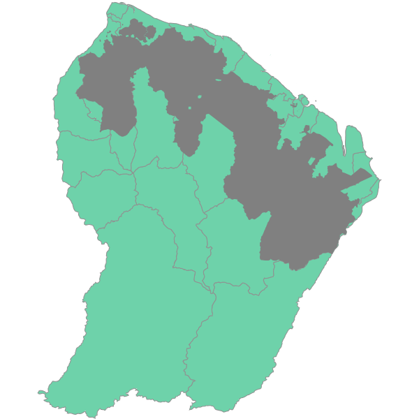
Domaine Forestier Permanent
Domaine Forestier de l'Etat, géré par l'ONF.
En application de l'ordonnance n° 2005-867 du 28/07/2005 qui met en œuvre le Code forestier en Guyane, le décret n° 2008-667 du 02/07/08 délimite les terrains à boiser et forêts de l'Etat en Guyane relevant du régime forestier.
Ces surfaces ainsi délimitées sont regroupées sous la dénomination usuelle de Domaine forestier permanent(DFP), appellation qui confirme, d'un point de vue réglementaire, la vocation forestière stricte de la zone.
Simple
- Date (Revision)
- 2018-06-04T13:49:51
- Date (Publication)
- 2011-08-11T21:13:00
- Citation identifier
- https://catalogue.geoguyane.fr/geonetwork/srv/af66be4c-1b2f-46f1-a554-2f9cdbcd8fa7
- Point of contact
-
Organisation name Individual name Electronic mail address Role ONF Guyane
Pôle SIG
-
Régions de France
-
-
GUYANE
-
-
INSPIRE inspires
-
-
Sites protégés
-
Usage des sols
-
- Keyword
-
GRAND_PUBLIC
- Keyword
-
AMENAGEMENT_FORESTIER
- Keyword
-
ONF
- Type
- Theme
- Date (Publication)
- 2023-11-08
- Keyword
-
GRAND_PUBLIC
- Keyword
-
AMENAGEMENT_FORESTIER
- Keyword
-
ONF
- Type
- Theme
- Date (Publication)
- 2023-11-08
- Keyword
-
GRAND_PUBLIC
- Keyword
-
ONF
- Keyword
-
AMENAGEMENT_FORESTIER
- Type
- Theme
- Date (Publication)
- 2023-11-08
- Access constraints
- Restricted
- Use constraints
- Copyright
- Classification
- Unclassified
- Spatial representation type
- Vector
- Denominator
- 5000
- Language
-
fre
- Character set
- UTF8
- Topic category
-
- Planning cadastre
- Description
-
Guyane
))
- Reference system identifier
- EPSG / RGFG95 / UTM zone 22N (EPSG:2972) / 7.9
- Distribution format
-
Name Version ESRI Shapefile
1.0
- OnLine resource
-
Protocol Linkage Name OGC:WFS-1.0.0-http-get-capabilities
https://datacarto.geoguyane.fr/wfs? DomaineForestierPermanent
WWW:LINK-1.0-http--link
http://www.legifrance.gouv.fr/affichTexte.do?cidTexte=JORFTEXT000019123194 Décret n° 2008-667 du 2 juillet 2008 délimitant les terrains à boiser et forêts de l'Etat en Guyane relevant du régime forestier
OGC:WMS-1.1.1-http-get-map
https://datacarto.geoguyane.fr/wms? dfp_poly
WWW:LINK-1.0-http--link
https://catalogue.geoguyane.fr/rss/atomfeed/atomdataset/af66be4c-1b2f-46f1-a554-2f9cdbcd8fa7 Accès au lien ATOM de téléchargement
OGC:WMS-1.1.1-http-get-map
https://datacarto.geoguyane.fr/wms? dfp_onf
OGC:WFS-1.0.0-http-get-capabilities
https://datacarto.geoguyane.fr/wfs? dfp_onf
WWW:LINK-1.0-http--link
https://catalogue.geoguyane.fr/rss/atomfeed/atomdataset/af66be4c-1b2f-46f1-a554-2f9cdbcd8fa7 Accès au lien ATOM de téléchargement
WWW:DOWNLOAD-1.0-http--download
https://telechargement.geoguyane.fr/download/af66be4c-1b2f-46f1-a554-2f9cdbcd8fa7 Accès au téléchargement des données
WWW:LINK-1.0-http--link
https://catalogue.geoguyane.fr/geosource/consultationWMS?IDT=15119 Accès à la visualisation des données
- Hierarchy level
- Dataset
Metadata
- File identifier
- af66be4c-1b2f-46f1-a554-2f9cdbcd8fa7 XML
- Metadata language
-
fre
- Character set
- UTF8
- Hierarchy level
- Dataset
- Date stamp
- 2018-06-04T13:52:55
- Metadata standard name
-
ISO 19115:2003/19139
- Metadata standard version
-
1.0
- Metadata author
-
Organisation name Individual name Electronic mail address Role ONF Guyane
Cellule SIG
Owner
Overviews

Spatial extent
Provided by
