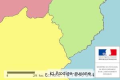
Territoires Leader en Guyane
Le programme européen Liaison Entre Actions de Développement Economique Rural (LEADER), dans sa troisième génération, fait partie intégrant du programme de développement rural de la Guyane (PDRG) sur la période 2007-2013. C'est l'axe 4 du PDRG. Il vise à mettre en oeuvre des stratégies de développement local sur des territoires, en s'appuyant sur un partenariat public-privé au sein d'un groupe d'action local (GAL). Ainsi quatre GAL ont été constitué en Guyane pour la période 2007-2013.
Simple
Identification info
- Date (Publication)
- 2011-07-28T18:01:00
- Citation identifier
- https://catalogue.geoguyane.fr/geonetwork/srv/837fff29-42d2-446d-b621-9c1d989bef1e
- Point of contact
-
Organisation name Individual name Electronic mail address Role DAAF Guyane
Thomas Requillart
Point of contact
-
Régions de France
-
-
GUYANE
-
-
INSPIRE Service taxonomy
-
-
infoMapAccessService
-
-
Domaines
-
-
DAAF
-
GEOGUYANE
-
POLITIQUE_EUROPEENNE
-
-
Domaines
-
-
DAAF
-
POLITIQUE_EUROPEENNE
-
GRAND_PUBLIC
-
- Use limitation
-
Utilisation libre sous réserve de mentionner la source (a minima le nom du producteur) et la date de sa dernière mise à jour
- Access constraints
- Other restrictions
- Use constraints
- Copyright
- Other constraints
-
Pas de restriction d’accès public selon INSPIRE
- Service Type
- invoke
- Description
-
Guyane
))
- Coupling Type
- Tight
- Contains Operations
-
Operation Name Distributed Computing Platforms Connect Point Accès au fichier contexte OWS de la carte
Web services https://carto.geoguyane.fr/context/getOws/13099 Accès à la carte interactive
Web services https://catalogue.geoguyane.fr/geosource/consultation?id=13099
- Coupled Resource
-
Operation Name Scoped name Identifier GetCapabilities
layer1 2bc50398-d5c8-40d2-b935-1d0e90586210
- Reference system identifier
- EPSG / RGFG95 / UTM zone 22N (EPSG:2972) / 7.9
- Distribution format
-
Name Version OGC:OWS-C
- Version en cours -
- Units of distribution
-
liens associés
- OnLine resource
-
Protocol Linkage Name WWW:LINK-1.0-http--link
https://catalogue.geoguyane.fr/geosource/consultation?id=13099 Accès à la carte
Conformance result
- Date
- 2012-01-05T15:08:00
- Pass
- Yes
- Statement
-
Le territoire de chacun des GAL est défini en annexe 1 de la convention de mise en oeuvre du plan de développement du GAL.
Metadata
- File identifier
- 837fff29-42d2-446d-b621-9c1d989bef1e XML
- Metadata language
-
fre
- Character set
- UTF8
- Hierarchy level
- Service
- Hierarchy level name
-
service
- Date stamp
- 2022-04-14T10:01:39
- Metadata standard name
-
ISO 19115:2003/19139
- Metadata standard version
-
1.0
- Metadata author
-
Organisation name Individual name Electronic mail address Role DAAF Guyane
matthieu DESCOMBES
Point of contact
Overviews
Spatial extent
Provided by
