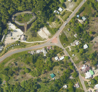
Orthophotographie Mana, secteur Charvein (2017)
Orthophotographie aérienne à 20cm de résolution produite dans le cadre d'une campagne d'acquisition de données réalisée par l'EPFA Guyane en 2017.
Simple
- Date (Revision)
- 2020-03-25T21:35:05
- Date (Publication)
- 2018-03-18
- Citation identifier
- https://catalogue.geoguyane.fr/geonetwork/srv/58f31ec7-a2c3-4b48-ba17-660b084183be
- Point of contact
-
Organisation name Individual name Electronic mail address Role EPFAG (Etablissement Public Foncier et d'Aménagement de la Guyane)
EPFA Guyane
Point of contact ALTOA
ALTOA
Processor
-
Régions de France
-
-
GUYANE
-
-
OPENDATA
-
-
open data
-
données ouvertes
-
-
GEMET - INSPIRE themes, version 1.0
-
-
Ortho-imagerie
-
-
Domaines
-
-
EPFAG
-
PHOTOS_AERIENNES
-
GRAND_PUBLIC
-
- Keywords
-
- Use limitation
-
Données ouvertes
- Access constraints
- Copyright
- Use constraints
- Copyright
- Spatial representation type
- Grid
- Denominator
- 25000
- Language
-
fre
- Character set
- UTF8
- Topic category
-
- Environment
- Description
-
Guyane française
))
- Reference system identifier
- EPSG / RGFG95 / UTM zone 22N (EPSG:2972) / 8.6
- Distribution format
-
Name Version ZIP
- OnLine resource
-
Protocol Linkage Name WWW:LINK-1.0-http--link
https://catalogue.geoguyane.fr/rss/atomfeed/atomdataset/58f31ec7-a2c3-4b48-ba17-660b084183be Accès au lien ATOM de téléchargement
OGC:WMS-1.1.1-http-get-map
https://datacarto.geoguyane.fr/wms?service=WMS&request=GetCapabilities donnees_EPAG_2017_ALTOA_Charvein_Orthophoto_ECW_ortho_2017_mana_charvein_tuilage_shp
WWW:DOWNLOAD-1.0-http--download
https://telechargement.geoguyane.fr/download/58f31ec7-a2c3-4b48-ba17-660b084183be WWW:LINK-1.0-http--link
https://catalogue.geoguyane.fr/rss/atomfeed/atomdataset/58f31ec7-a2c3-4b48-ba17-660b084183be Accès au lien ATOM de téléchargement
WWW:DOWNLOAD-1.0-http--download
https://telechargement.geoguyane.fr/download/58f31ec7-a2c3-4b48-ba17-660b084183be Accès au téléchargement des données
WWW:LINK-1.0-http--link
https://catalogue.geoguyane.fr/geosource/consultationWMS?IDT=46282709 Accès à la visualisation des données
- Hierarchy level
- Dataset
Conformance result
- Date (Publication)
- 2010-10-15T00:00:00
- Explanation
-
cf. la spécification citée
- Pass
- Yes
- Statement
-
Acquisition réalisée par la société ALTOA en septembre 2017. Les données brutes d'origine ainsi que l'ensemble des documents (rapports, plans de vol, données de calibrage, etc.) sont disponibles à l'EPFA Guyane.
Metadata
- File identifier
- 58f31ec7-a2c3-4b48-ba17-660b084183be XML
- Metadata language
-
fre
- Character set
- UTF8
- Hierarchy level
- Dataset
- Date stamp
- 2022-04-22T10:50:53
- Metadata standard name
-
ISO 19115:2003/19139
- Metadata standard version
-
1.0
- Metadata author
-
Organisation name Individual name Electronic mail address Role EPFAG (Etablissement Public Foncier et d'Aménagement de la Guyane)
Administrateur SIG
Point of contact
Overviews
Spatial extent
Provided by
