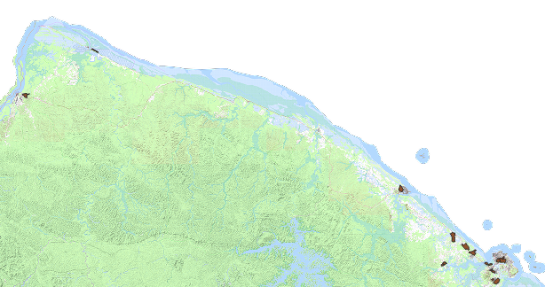
Périmètres des Zones d’Aménagement Différé (ZAD) en Guyane,2024
Les arrêtés R03-2023-05-22-00001, R03-2023-01-23-00007 et R03-2023-01-10-00001 définissent respectivement les périmètres de Zones d'Aménagement Différé (ZAD) sur les secteurs OIN des communes de Cayenne (OIN n°1 - Palika et OIN n°2 - Tigre-Maringouin), Macouria (OIN n°15 - Porte de Soula-Sablance ; OIN n°16 - Maillard-Elysée-Parépou et OIN n°17 - Sud Bourg Tonate) et Mana (OIN n°19 - Dégrad-Canard).
L’établissement public foncier d’aménagement de Guyane (EPFAG) est désigné comme titulaire du droit de préemption sur ces périmètres pour une durée de 6 ans renouvelable."
Simple
- Date (Revision)
- 2025-01-10T13:24:52
- Date (Creation)
- 2024-06-06
- Citation identifier
- https://catalogue.geoguyane.fr/geonetwork/srv/2d8ad5f1-69b3-4203-ad42-39715b33f27d
- Point of contact
-
Organisation name Individual name Electronic mail address Role DGTM Guyane
Chargé(e) de mission analyses, connaissance du territoire et mise en place de l'OIN
Point of contact
-
Régions de France
-
-
GUYANE
-
-
OPENDATA
-
-
données ouvertes
-
open data
-
-
GEMET - INSPIRE themes, version 1.0
-
-
Usage des sols
-
- Theme
-
-
ZAD
-
- Keywords
-
-
ZONE AMENAGEMENT DIFFERE
-
-
Domaines
-
-
ZONAGES_AMENAGEMENT
-
GRAND_PUBLIC
-
DGTM
-
- Use limitation
-
Données ouvertes
- Access constraints
- Other restrictions
- Use constraints
- Copyright
- Other constraints
-
Licence Ouverte 2.0 https://www.etalab.gouv.fr/licence-ouverte-open-licence
- Classification
- Unclassified
- Spatial representation type
- Vector
- Denominator
- 5000
- Language
-
fre
- Character set
- UTF8
- Topic category
-
- Planning cadastre
- Description
-
Guyane française
))
- Reference system identifier
- EPSG / RGFG95 / UTM zone 22N (EPSG:2972) / 8.6
- Distribution format
-
Name Version ESRI Shapefile
1.0
- OnLine resource
- Hierarchy level
- Dataset
Conformance result
- Date (Publication)
- 2010-10-06T00:00:00
- Explanation
-
cf. la spécification citée
- Pass
- Yes
- Statement
-
Données réalisées par l'EPAG à partir du référentiel cadastral et mises à jour par la DGTM
Metadata
- File identifier
- 2d8ad5f1-69b3-4203-ad42-39715b33f27d XML
- Metadata language
-
fre
- Character set
- UTF8
- Hierarchy level
- Dataset
- Date stamp
- 2025-01-10T09:24:26
- Metadata standard name
-
ISO 19115:2003/19139
- Metadata standard version
-
1.0
- Metadata author
-
Organisation name Individual name Electronic mail address Role DGTM Guyane
Administrateur de données localisées
Point of contact
Overviews
Spatial extent
Provided by
