Ensemble du territoire de Guyane situé en dehors d'une zone agricole
Ensemble du territoire de Guyane situé en dehors d'une zone agricole
Simple
- Date (Revision)
- 2023-07-07T17:04:36
- Date (Publication)
- 2016-07-16T08:00:00
- Date (Creation)
- 2016-07-02T08:00:00
- Citation identifier
- https://catalogue.geoguyane.fr/geonetwork/srv/105e7769-275f-4080-827d-f456d638755b
- Point of contact
-
Organisation name Individual name Electronic mail address Role DAAF Guyane
Thomas REQUILLART
Point of contact
-
OPENDATA
-
-
données ouvertes
-
open data
-
-
Régions de France
-
-
GUYANE
-
-
GEMET - INSPIRE themes, version 1.0
-
-
Usage des sols
-
-
Domaines
-
-
ZONAGES_PLANIFICATION
-
ZONAGES_AGRICOLE
-
DAAF
-
GRAND_PUBLIC
-
-
Domaines
-
-
ZONAGES_PLANIFICATION
-
ZONAGES_AGRICOLE
-
DAAF
-
GRAND_PUBLIC
-
-
Domaines
-
-
ZONAGES_PLANIFICATION
-
ZONAGES_AGRICOLE
-
DAAF
-
GRAND_PUBLIC
-
- Keywords
-
- Use limitation
-
Données ouvertes
- Access constraints
- Other restrictions
- Other constraints
-
Pas de restriction d’accès public selon INSPIRE
- Spatial representation type
- Vector
- Denominator
- 25000
- Language
-
fre
- Character set
- UTF8
- Topic category
-
- Farming
- Description
-
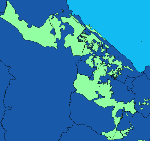
Guyane française
))
- Begin date
- 2016-01-01T00:00:00
- End date
- 2018-01-01T00:00:00
- Reference system identifier
- EPSG / RGFG95 / UTM zone 22N (EPSG:2972) / 7.9
- Distribution format
-
Name Version ESRI Shapefile
1.0
- OnLine resource
-
Protocol Linkage Name OGC:WFS-1.0.0-http-get-capabilities
https://datacarto.geoguyane.fr/wfs? l_hors_zone_agricole
OGC:WMS-1.1.1-http-get-map
https://datacarto.geoguyane.fr/wms? l_hors_zone_agricole
WWW:LINK-1.0-http--link
https://catalogue.geoguyane.fr/rss/atomfeed/atomdataset/105e7769-275f-4080-827d-f456d638755b Accès au lien ATOM de téléchargement
OGC:WMS-1.1.1-http-get-map
https://datacarto.geoguyane.fr/wms? l_hors_zone_agricole_2019
OGC:WFS-1.0.0-http-get-capabilities
https://datacarto.geoguyane.fr/wfs? l_hors_zone_agricole_2019
WWW:DOWNLOAD-1.0-http--download
https://telechargement.geoguyane.fr/download/105e7769-275f-4080-827d-f456d638755b Accès au téléchargement des données
WWW:LINK-1.0-http--link
https://catalogue.geoguyane.fr/geosource/consultationWMS?IDT=1606512 Accès à la visualisation des données
- Hierarchy level
- Dataset
Conformance result
- Date (Publication)
- 2016-07-16
- Explanation
-
cf. la spécification citée
- Statement
-
Découpage de la couche département par la couche zone agricole
Metadata
- File identifier
- 105e7769-275f-4080-827d-f456d638755b XML
- Metadata language
-
fre
- Character set
- UTF8
- Hierarchy level
- Dataset
- Date stamp
- 2023-07-07T11:04:36
- Metadata standard name
-
ISO 19115:2003/19139
- Metadata standard version
-
1.0
- Metadata author
-
Organisation name Individual name Electronic mail address Role DAAF Guyane
Thomas REQUILLART
Point of contact
Overviews
Spatial extent
Provided by
