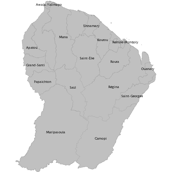
Limites des communes de Guyane
Limites des communes de Guyane.
Cette donné ne doit en aucun cas être supprimée puis-qu’utilisée par de nombreuses cartes. Dans le cas contraire, le fonctionnement de Géoguyane serait altéré.
Simple
- Date (Revision)
- 2023-09-27T15:38:23
- Citation identifier
- https://catalogue.geoguyane.fr/geonetwork/srv/e740c7ef-c038-48c4-afb9-b62bf87c0c30
- Point of contact
-
Organisation name Individual name Electronic mail address Role AUDeG - Agence d'Urbanisme et de Développement de la Guyane
Accueil
Point of contact
-
Régions de France
-
-
GUYANE
-
-
INSPIRE inspires
-
-
Unités administratives
-
-
OPENDATA
-
-
données ouvertes
-
open data
-
- Keywords
-
- Use limitation
-
Utilisation libre sous réserve de mentionner la source (a minima le nom du producteur) et la date de sa dernière mise à jour.
- Access constraints
- Other restrictions
- Other constraints
-
Pas de restriction d’accès publique
- Spatial representation type
- Vector
- Denominator
- 5000
- Language
-
fre
- Character set
- UTF8
- Topic category
-
- Boundaries
- Description
-
Guyane française
))
- Distribution format
-
Name Version ESRI Shapefile
1.0
- OnLine resource
- Hierarchy level
- Dataset
Conformance result
- Date (Publication)
- 2010-11-13
- Explanation
-
cf. la spécification citée
- Pass
- Yes
- Statement
-
Réalisé à partir de la BD topo IGN. Série de données nécessaire à l'administration de la plateforme.
Metadata
- File identifier
- e740c7ef-c038-48c4-afb9-b62bf87c0c30 XML
- Metadata language
-
fre
- Character set
- UTF8
- Hierarchy level
- Dataset
- Date stamp
- 2023-09-27T09:38:24
- Metadata standard name
-
ISO 19115:2003/19139
- Metadata standard version
-
1.0
- Metadata author
-
Organisation name Individual name Electronic mail address Role AUDeG - Agence d'Urbanisme et de Développement de la Guyane
Accueil
Point of contact
Overviews
Spatial extent
Provided by
