 GéoGuyane
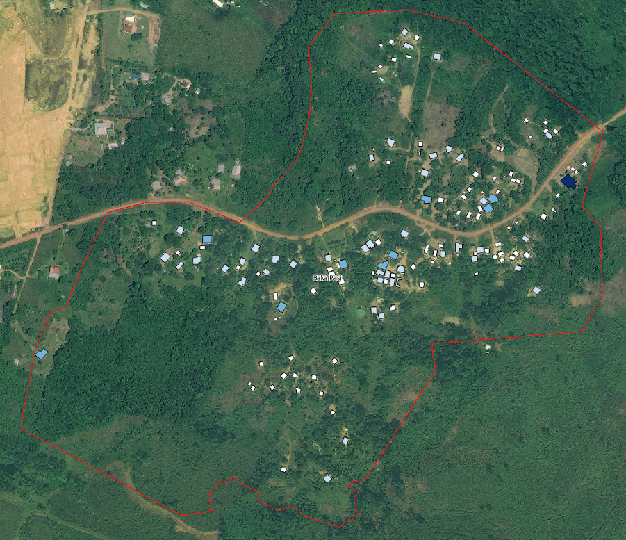
Bati spontané quartier Baka Pasi, Saint-Laurent du Maroni 2011
Bati spontané du quartier Baka Pasi à Saint-Laurent du Maroni 2011 vectorisé à partir d'images satellites fournies par l'EPFA Guyane (LEEISA, feder OYAMAR)
Simple
- Date (Revision)
- 2019-10-30T19:02:57
- Date (Creation)
- 2018-11-09
- Régions de France
-
- GUYANE
- OPENDATA
-
- open data
- données ouvertes
- GEMET - INSPIRE themes, version 1.0
-
- Bâtiments
- Domaines
-
- CNRS
- GEOGUYANE
- CONSTRUCTION
- Domaines
-
- CONSTRUCTION
- CNRS
- GEOGUYANE
- Use limitation
- Données ouvertes
- Access constraints
- Copyright
- Use constraints
- Copyright
- Spatial representation type
- Vector
- Denominator
- 5000
- Metadata language
- fre
- Character set
- UTF8
- Topic category
-
- Structure
- Society
- Description
- Guyane française
N
S
E
W
))
- Reference system identifier
- EPSG / RGFG95 / UTM zone 22N (EPSG:2972) / 8.6
- Hierarchy level
- Dataset
Conformance result
- Date (Publication)
- 2010-08-02T00:00:00
- Explanation
- cf. la spécification citée
- Pass
- Yes
- Statement
- Bati spontané du quartier Baka Pasi à Saint-Laurent du Maroni 2011 vectorisé à partir d'images satellites fournies par l'EPFA Guyane
- File identifier
- da4df6ce-4f2b-4557-96f1-9cf1904bc6d5 XML
- Metadata language
- fre
- Character set
- UTF8
- Hierarchy level
- Dataset
- Date stamp
- 2019-11-05T09:16:34
- Metadata standard name
- ISO 19115:2003/19139
- Metadata standard version
- 1.0
Overviews
Spatial extent
N
S
E
W
Provided by

Associated resources
Not available